Hokkaido Travel Guide: Ten Places Beyond Sapporo
Hokkaido doesn't feel like the rest of Japan. Settled at scale only in the late 19th century, the newness shows: grid-pattern cities, dairy farms, brown bears in the river valleys, no ancient temples. The south has Hakodate's Meiji-era foreign quarter and Noboribetsu's geothermal drama; the east has wilderness that would be extraordinary on any continent — crane marshes, UNESCO bears, spherical algae growing a millimetre per year. The centre turns entirely purple in July.
What ties it together is the cold. Even in summer, Hokkaido runs 10°C cooler than Tokyo, and it shapes everything — the food (dairy, lamb, cold-water seafood), the pace, and the length of stay the island rewards, which is always longer than planned.
Hokkaido is the part of Japan that requires a different approach. The distances are real, the seasons are extreme, and the rewards — wildlife, volcanic landscapes, some of the best seafood in the country — are proportional. These ten places cover the island from the familiar to the genuinely remote.
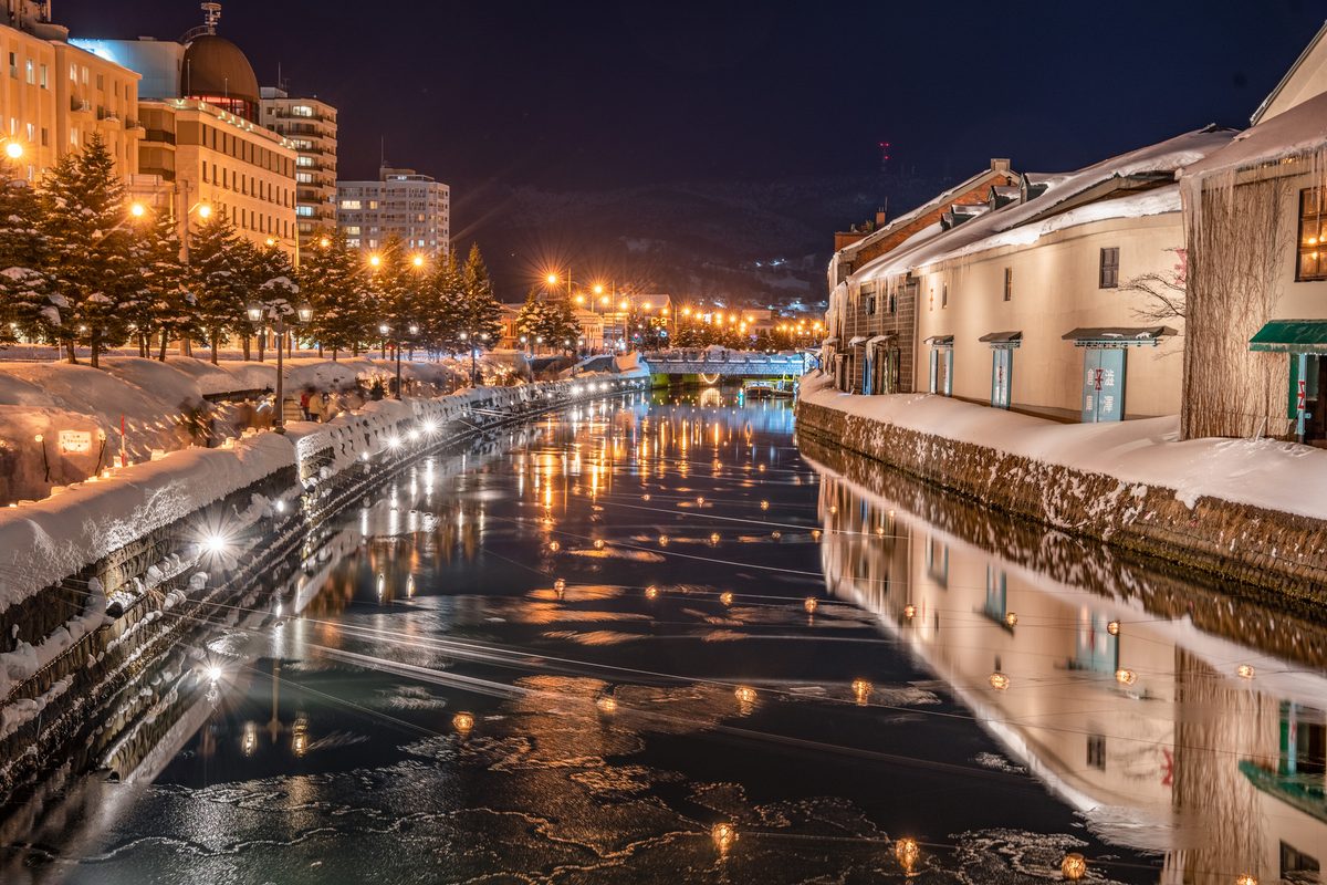
Otaru — The City That Forgot to Modernise
Otaru sits 40 minutes west of Sapporo by train, and the contrast is immediate. Where Sapporo sprawls and modernises, Otaru has kept its banking district, canal warehouses, and Herring Mansion exactly as they were left when the money ran out in the 1930s. The result is one of Hokkaido's most photogenic cities — and one that still actually functions, with sake breweries, sushi counters, and a working fishing port.
The canal is original, not a reconstruction. The stone warehouses along Otaru Unga now hold bars and restaurants, but the bones are the real thing. Come early on a winter morning and you'll have the lantern-lit waterfront largely to yourself. The Kitaichi Glass and music box shops are tourist-facing; the morning market and the covered shopping arcade behind the station belong to the town.
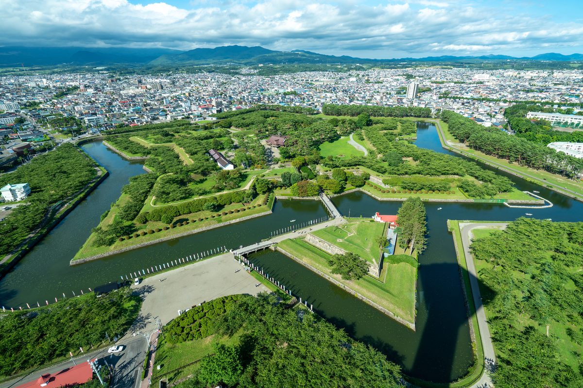
Explore Hokkaido spotsHakodate — Where Japan Remembers It Has an Edge
Hakodate is shaped by geography: a narrow peninsula with sea on both sides, a mountain at the end, and a history of being the first place in Japan to open to foreign trade in 1854. The Western-style buildings on the hillside, the red-brick warehouses by the waterfront, and the morning fish market that starts before 6am carry the weight of a city that was briefly as consequential as Yokohama.
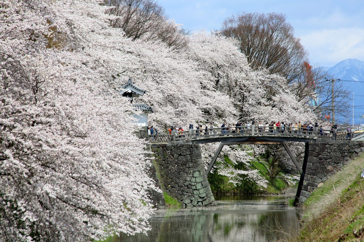
The night view from the ropeway up Mt. Hakodate is justifiably famous. More interesting is the Motomachi district below — 19th-century consulates, a Russian Orthodox church, and former merchant houses on steep streets above the port. The Goryokaku star fort, built in 1864 and the site of the last battle of the Boshin War, is best seen from the tower alongside it in late April when the cherry trees inside the moat are in full bloom.
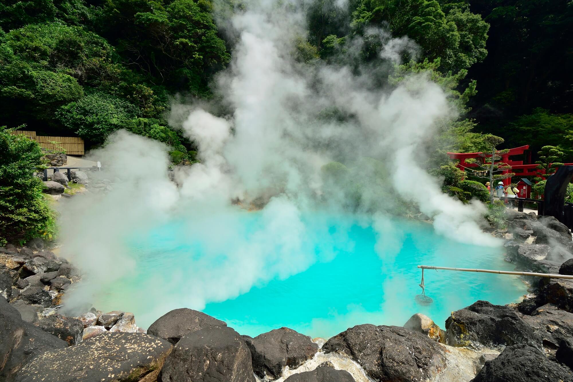
Explore Hokkaido spotsNoboribetsu — Where the Earth Reminds You It's Still Alive
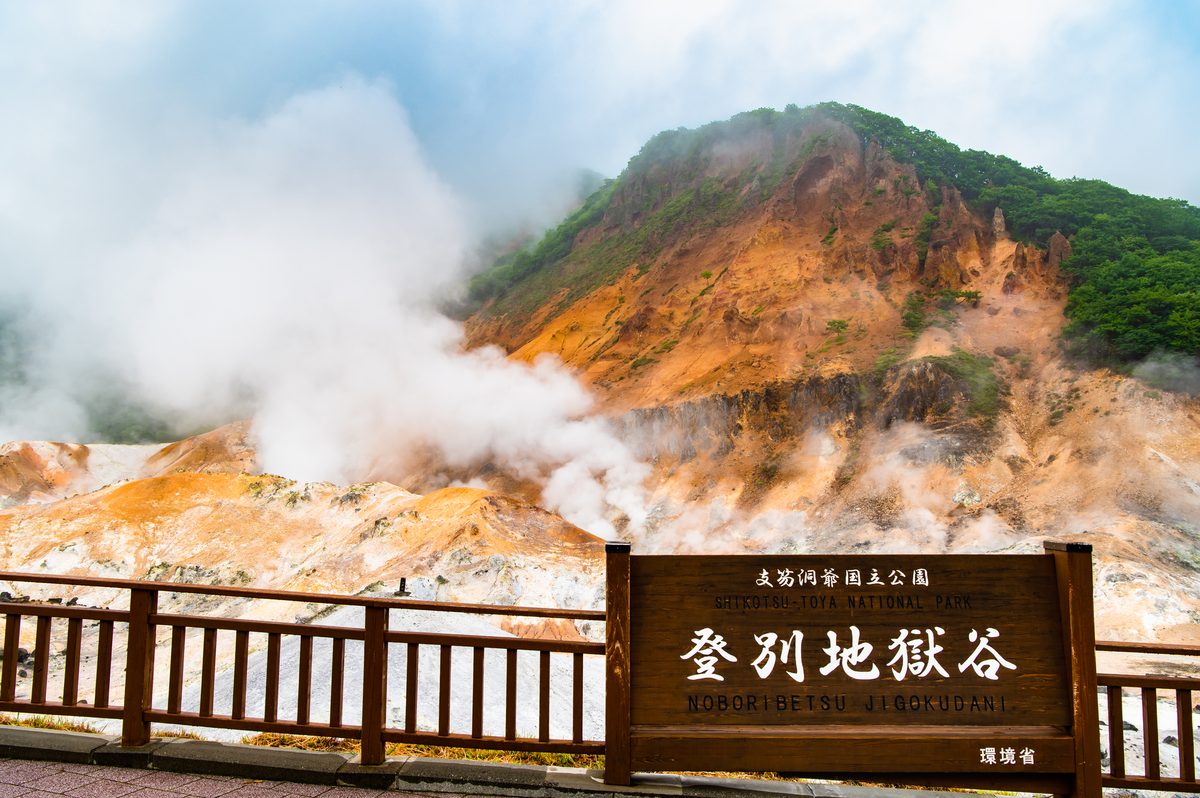
Noboribetsu's Jigokudani (Hell Valley) earns the name. The crater steams constantly, the ground runs yellow with sulphur, and the onsen ryokan in the valley below pump mineral water from nine different spring types. It is a town that exists entirely because the earth happens to be boiling here.
The springs are the point: sodium chloride, iron, hydrogen sulphide, alum — Noboribetsu has more spring chemistry than almost any other resort in Japan. Book a ryokan with a rotenburo facing the valley and arrive before 3pm, when the day-trippers leave and the place recovers its character.
Explore Hokkaido spotsLake Toya & Showa-Shinzan — A Landscape Still Being Written
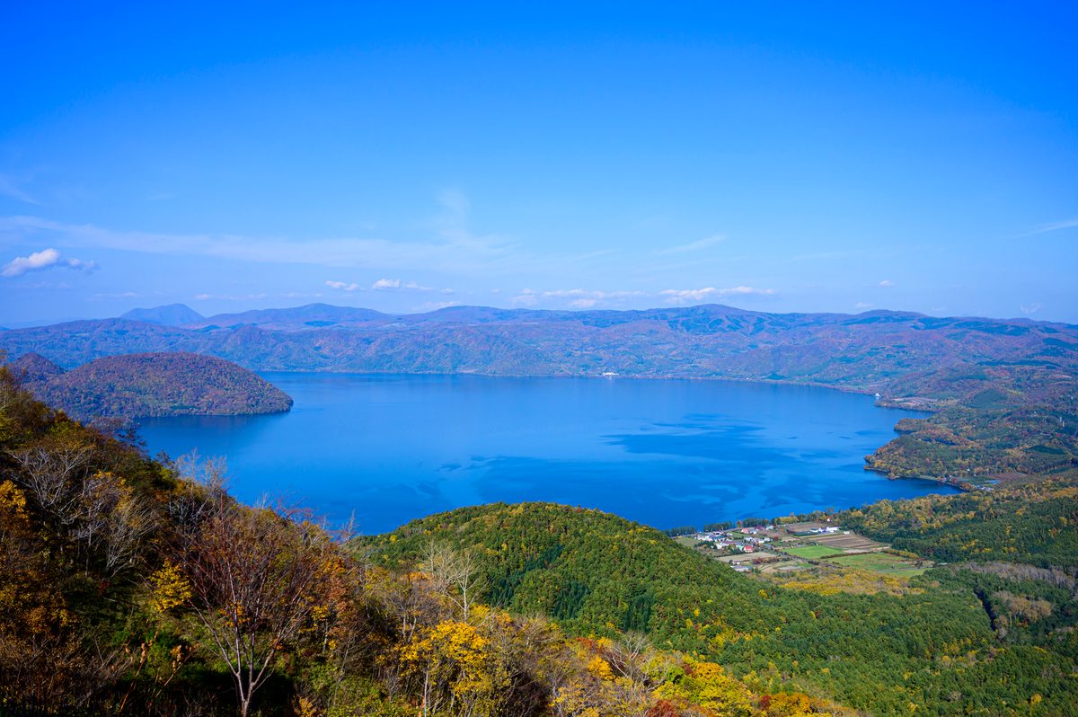
Lake Toya is a near-perfect circular caldera, and from the southern shore you can see Nakajima island in the centre with Mt. Yotei — Hokkaido's cone-shaped answer to Fuji — on the horizon. That would already be a complete scene. Then there is Showa-Shinzan a few kilometres away: a lava dome that rose from a wheat field in 1943 and grew for two years, still monitored by volcanologists today.
The combination of the serene lake and the aggressively new volcano makes Toya one of the most geologically compelling places in Japan. The Toyako Visitor Centre documents the 2000 eruption that sent lava beneath the town without destroying the hotels — though several buildings remain half-buried as a permanent record of how close it came.
Explore Hokkaido spots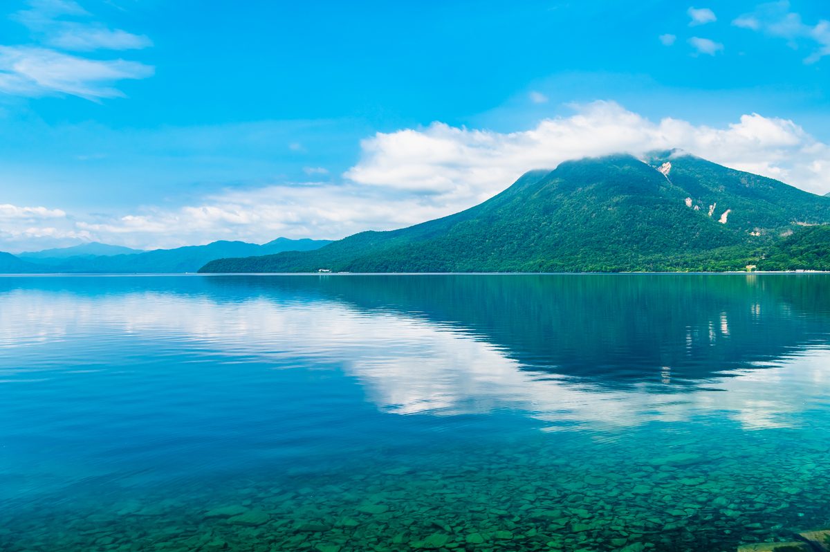
Furano & Biei — The Hokkaido That Ended Up on Calendars
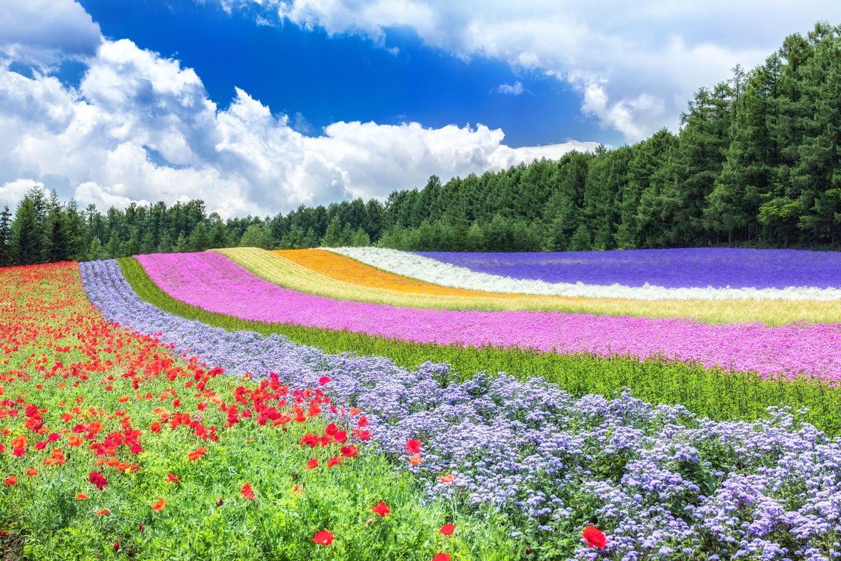
The problem with Furano in July is that it's busy because it's genuinely extraordinary: a broad valley of lavender, sunflower, and canola laid out across rolling farmland at a scale that doesn't feel Japanese. Farm Tomita has been running since 1976 and knows exactly what it is doing. The lavender ice cream is not ironic.
Biei, 30 minutes north, is more interesting outside peak season: patchwork fields of wheat, potato, and corn on low hills punctuated by solitary oaks and poplars that have become photographic landmarks in their own right. A rental car or bicycle is the only practical way to see it properly — the coach tours stick to the car parks and miss the empty farm roads between them.
Explore Hokkaido spotsDaisetsuzan (Asahidake) — Japan's Largest National Park, With Room to Prove It
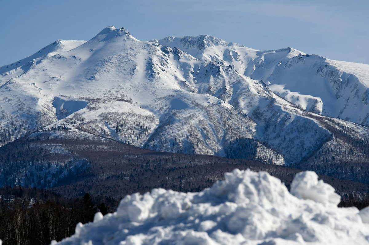
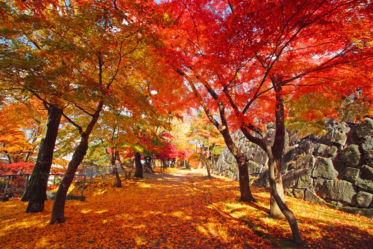
Daisetsuzan covers 2,267 square kilometres of central Hokkaido and contains Japan's highest concentration of alpine terrain outside the Japan Alps. The Asahidake ropeway lifts you to 1,600 metres in ten minutes, where the landscape becomes moorland, volcanic vents, and — in September — the first autumn colour in the country, arriving weeks ahead of anywhere else.
The standard loop hike from Asahidake Onsen takes six hours and requires no technical skill, just waterproofs and proper footwear. In early October the birch forests turn yellow-white against volcanic rock and the trails are quiet once the school holidays are over. Asahidake Onsen has a handful of small ryokan that book out months in advance for the autumn colour season.
Explore Hokkaido spotsAkan & Kushiro — Cranes, Marimo, and the Scale of the East
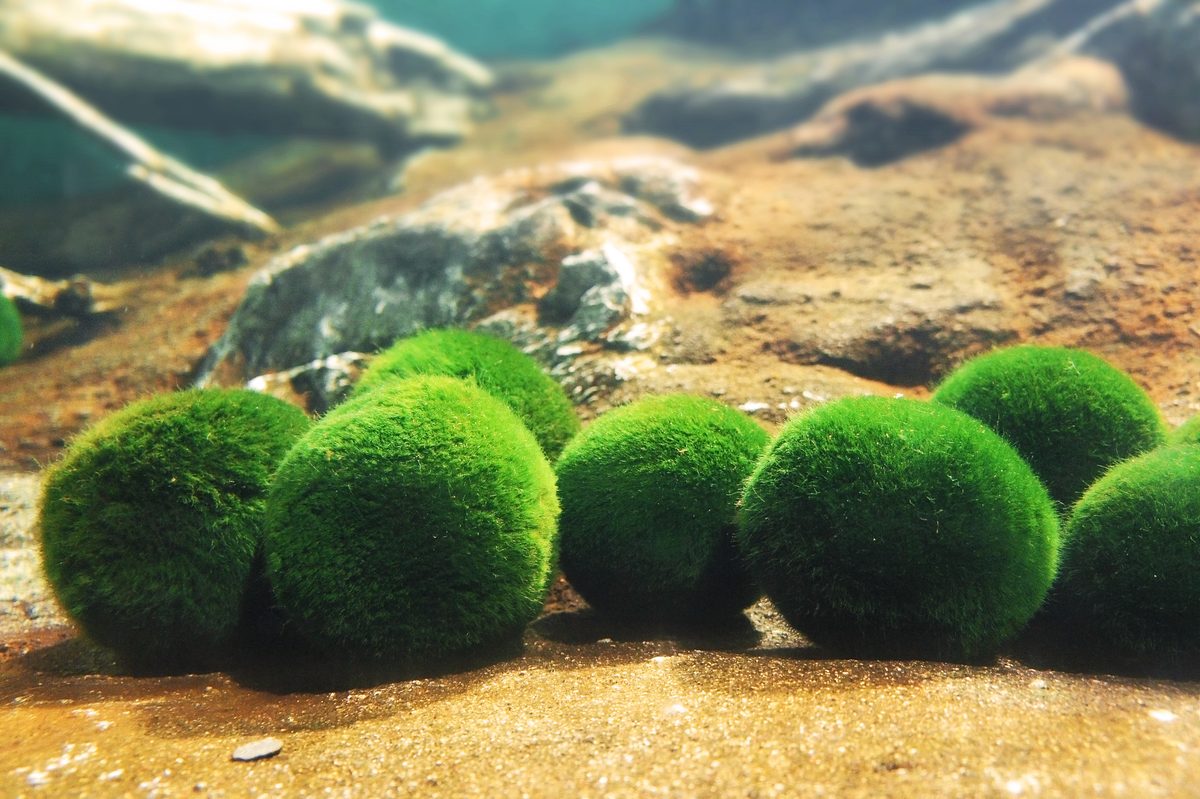
Eastern Hokkaido operates at a different pace. Kushiro Marsh is Japan's largest wetland, and in winter the red-crowned cranes gather at the feeding stations at Tsurui in numbers that feel like encountering something ancient still functioning. Lake Akan is home to marimo — spherical algae that grow a millimetre per year and take centuries to reach tennis-ball size.
The town of Akan Onsen is small and slightly faded, which is part of its appeal. The Ainu Kotan district — a working Ainu community rather than a heritage recreation — offers genuine contact with indigenous Hokkaido culture. The evening dance performances at the community hall are low-key and straightforward.
Explore Hokkaido spotsShiretoko Peninsula — The End of Japan
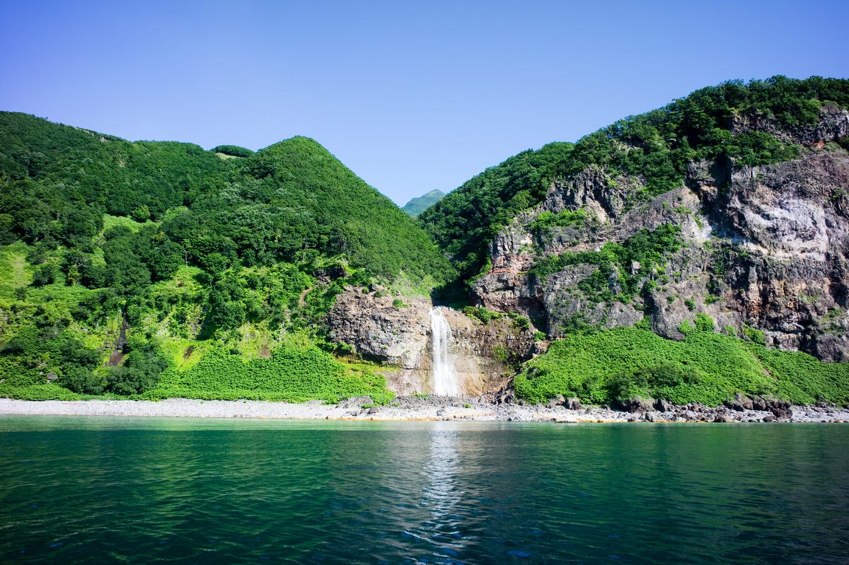
Shiretoko is the easternmost point of Japan accessible by road, a UNESCO World Heritage site, and one of the few places in the country where brown bear encounters require actual planning rather than theoretical awareness. The five lakes trail operates a guided-group system in July and August specifically because the bears are present in numbers.
The Shiretoko Five Lakes walk, the Furepe waterfall that drops directly from a cliff into the sea, and the boat tours around Cape Shiretoko — where there are no roads at all — are experiences without equivalent elsewhere in Japan. The nearest large town is Kushiro, 2.5 hours away. That distance is not a problem. It is the condition that makes Shiretoko what it is.
Explore Hokkaido spotsShakotan Peninsula — Hokkaido's Forgotten Coast
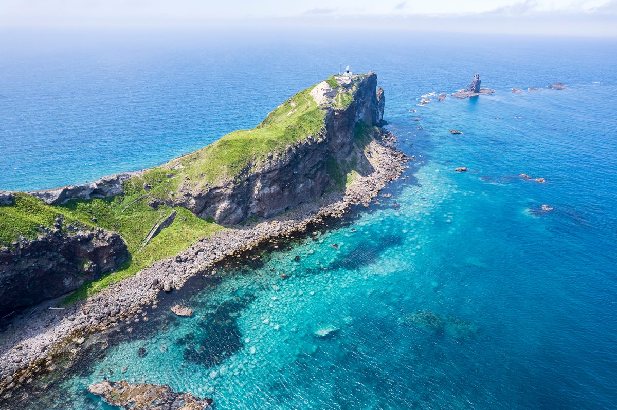
Shakotan sits two hours west of Sapporo on roads that appear in almost no standard Hokkaido itinerary. The peninsula is a sequence of basalt cliffs dropping into water that shifts from deep green to cobalt blue depending on the light — a colour with its own name in Japanese: Shakotan Blue. The sea urchin fished from these waters between June and August is considered among the best in Japan.
The village at the cape tip has a single sea urchin processing operation that sells bowls directly to visitors at a fraction of Sapporo prices. There are no crowds, because there is no particular reason to come here beyond the view and the food. Both are exceptional.
Explore Hokkaido spotsHow to Plan Your Hokkaido Trip
Hokkaido is larger than Ireland and the distances between these places are significant. Otaru and Hakodate work on public transport from Sapporo; everything east of Furano is substantially easier with a rental car. Roads are well-maintained and signposted in English; international driving permits are accepted throughout the island.
Three practical approaches: a southern loop (Sapporo–Otaru–Noboribetsu–Toya–Hakodate, 5–7 days by train), a central and eastern circuit (Sapporo–Furano–Daisetsuzan–Akan–Shiretoko, 7–10 days by car), or the full crossing combining both that requires two weeks. In winter, Noboribetsu and the ski areas near Niseko and Furano take priority, and eastern Hokkaido roads require winter driving experience — request studded tyres when booking.
Where are these spots?
How to Get There
Tokyo to Hokkaido: Fly to New Chitose Airport (CTS), 1.5 hours from Haneda or Narita. Flights run frequently and are often cheaper than the Shinkansen to other regions. From New Chitose, Sapporo is 40 minutes by airport express.\n\nFrom Osaka or Kyoto: Fly from Itami or Kansai International to New Chitose, approximately 1.5–2 hours. The Shinkansen-to-Tokyo-then-flight option adds significant time and cost.\n\nWithin Hokkaido: Otaru and Hakodate are comfortably accessible by train from Sapporo. For Noboribetsu, Toya, Furano, Daisetsuzan, and everywhere east of Sapporo, a rental car makes a decisive difference. Roads are well-maintained; international driving permits are accepted. In winter, request a vehicle with studded tyres and allow extra travel time on any route east of Asahikawa.
Find your Japan
Ready to See the Real Hokkaido?
Browse curated spots across Hokkaido — from canal-side Otaru to the bear country of Shiretoko. Filter by season, category, and how far off the map you want to go.
Find match spotsMore Prefecture Guides
Kagawa: Udon, Art Islands, and the Most Climbed Stairs in Shikoku
11 min read
Tokushima: Whirlpools, the Valley That Time Missed, and Japan's Loudest Dance
11 min read
Kochi: The Wild Coast That Japan Forgot to Tame
12 min read
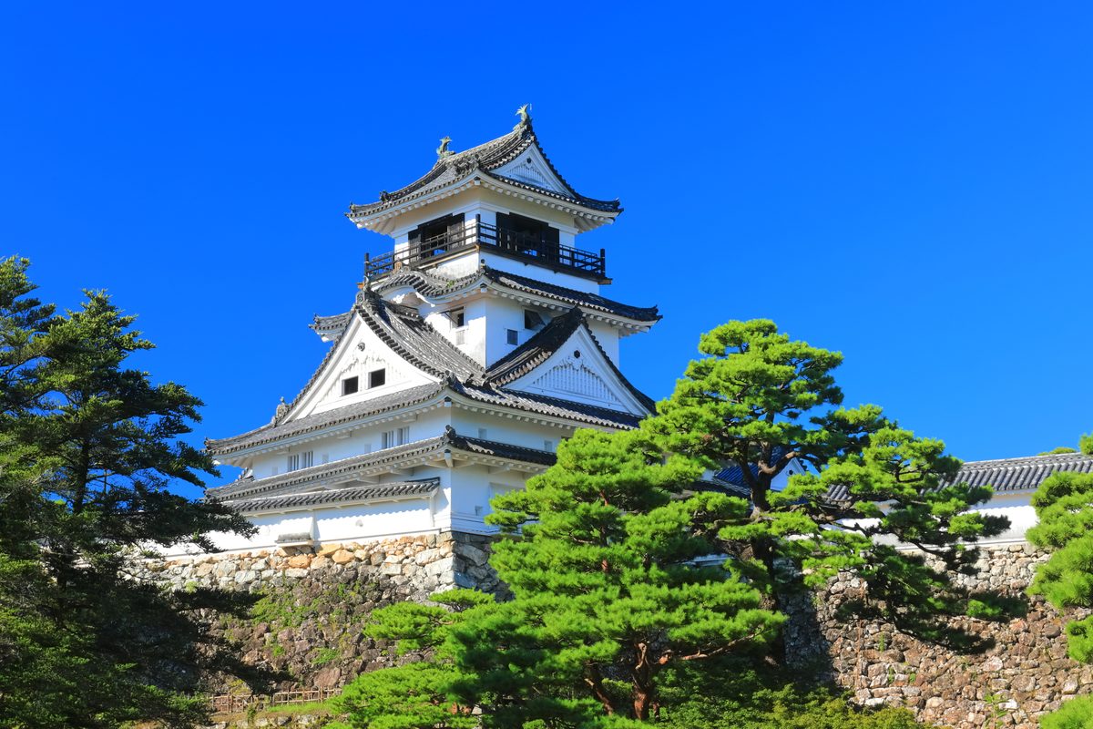
Ehime: Islands, Castles, and the Road That Goes Between
13 min read
Fukushima: Three Regions, One Prefecture, No Simple Story
12 min read
Akita: Snow Country, Rice Country, and Monsters on New Year's Eve
12 min read
Yamagata: Cherries, Sacred Mountains, and Snow That Eats the Trees
12 min read
Miyagi: The Coast, the Castle, and Sendai Between Them
11 min read
Iwate: Where the Mountains Lean Against the Pacific
12 min read
Aomori: Where Winter Invented Its Own Festival
12 min read
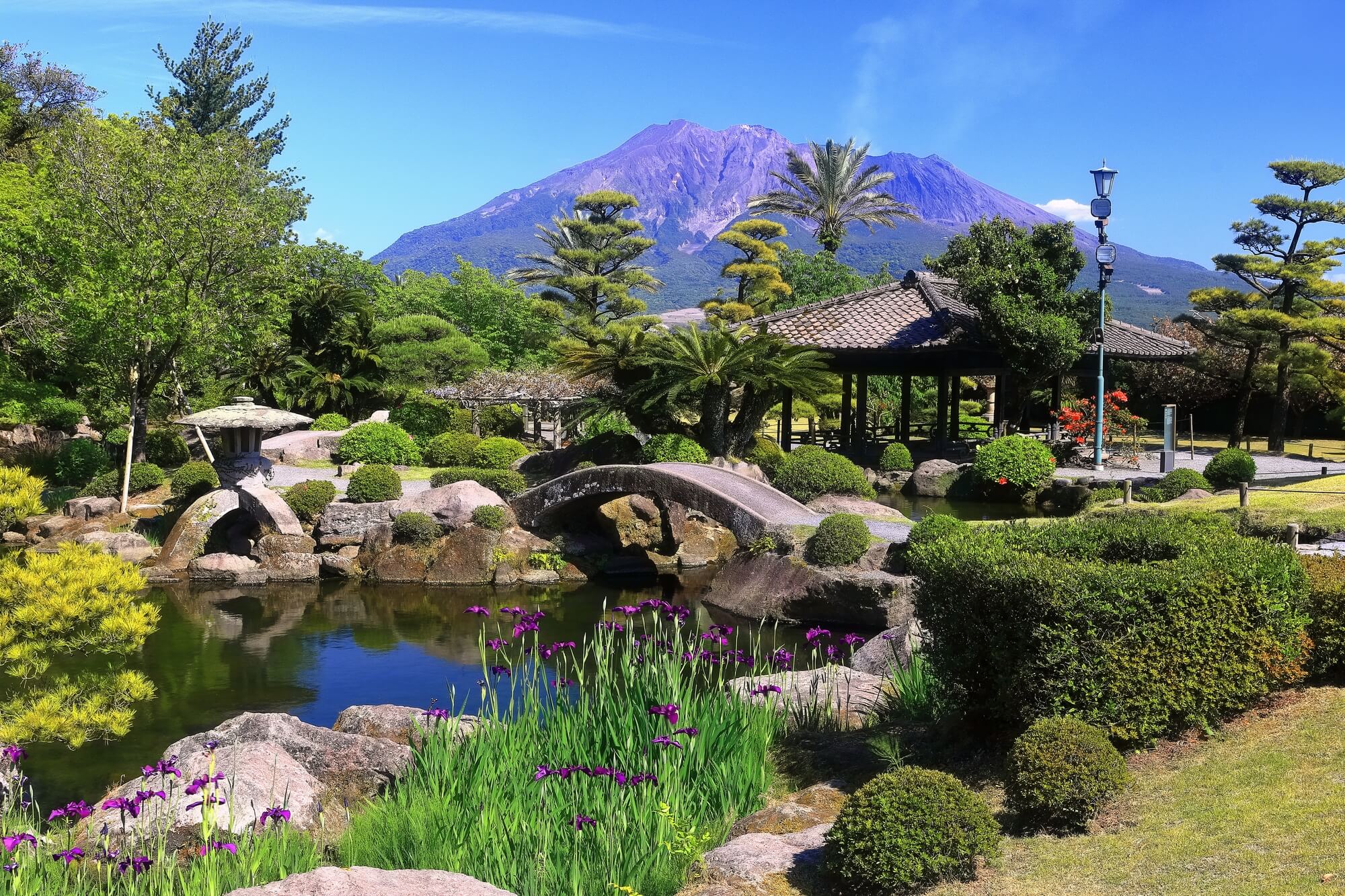
Kagoshima: Where the Mainland Finally Runs Out of Land
12 min read
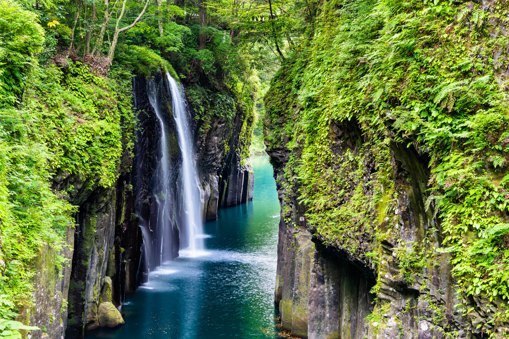
Miyazaki: Where the Sun God Hid and the Horses Run Wild
11 min read
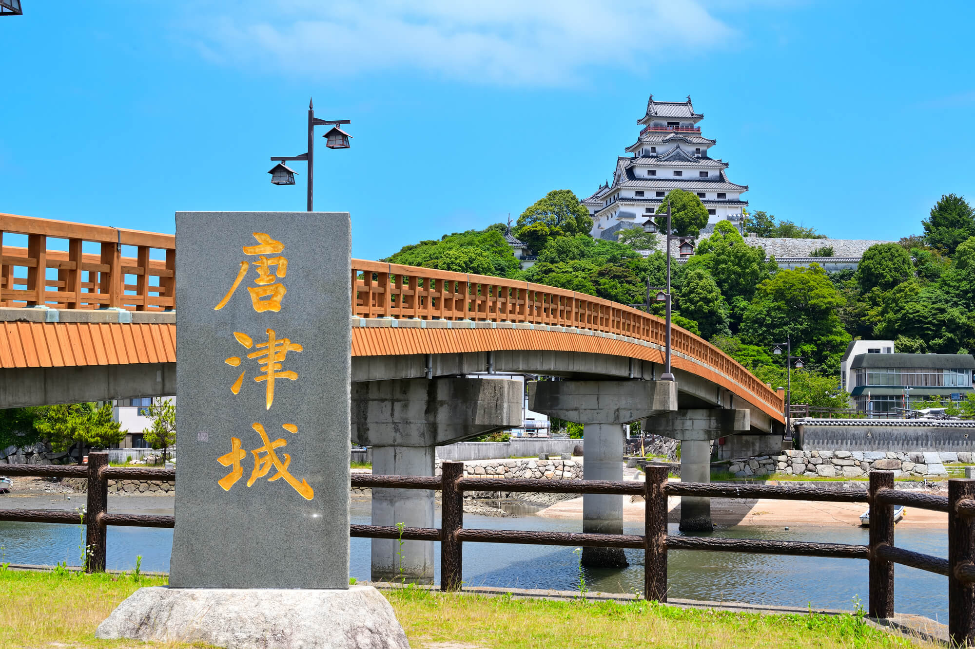
Saga: Older Than You Think, Quieter Than Most
11 min read
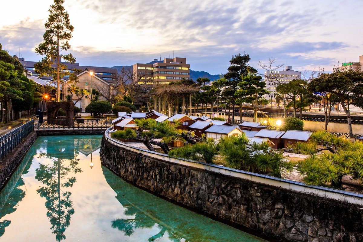
Nagasaki: Where Every Century Left Something Behind
13 min read
Oita: Where the Earth Still Boils
12 min read
Fukuoka: Where Japan Eats, Breathes, and Gets On With It
14 min read