Iwate: Where the Mountains Lean Against the Pacific
Iwate carries itself with the patience of a place that has never expected to be convenient. The towns are small, the trains are infrequent outside the Shinkansen corridor, and the weather does what northern Tohoku weather does — long winters, humid summers, sudden fog in the mountains. What the prefecture offers in exchange is space: forest that has not been fully converted to plantation, coastlines that remain sparsely built despite reconstruction, and a cultural memory deep enough that Hiraizumi's brief golden age still shapes how the region understands itself.
Iwate is the second-largest prefecture in Honshu and one of the least densely populated. The Ou Mountains run north–south through the centre; to the east, short rivers cut through forest to the Sanriku coast, where the 2011 tsunami reshaped entire towns. To the west, Hiraizumi once aspired to rival Kyoto. Nothing here is compact, and that is largely the point — the distances between places are real, and the landscape rewards those who accept them.
Morioka & Koiwai — Castle Ruins, Three Noodles, and a Farm the Size of a Town
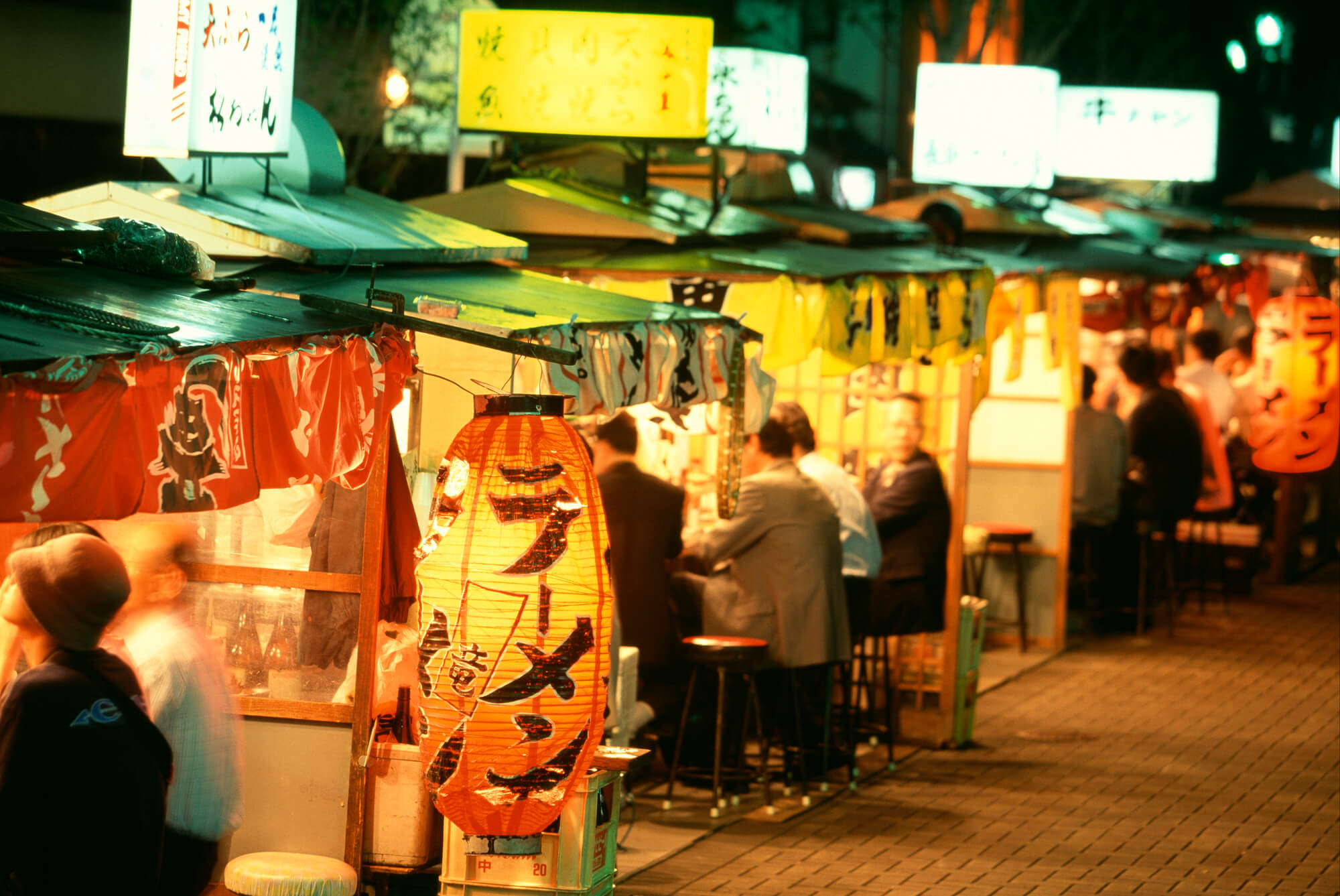
Morioka is the capital of Iwate and the practical base for most itineraries — well connected by Shinkansen, walkable in the centre, and organised around food in a way that smaller regional cities rarely sustain. The city claims three distinct noodle traditions: wanko soba, served in tiny bowls until you concede defeat; jajamen, a miso-meat topping on thick udon; and reimen, cold chewy noodles in chilled broth that became nationally famous through Korean diaspora communities in the region.
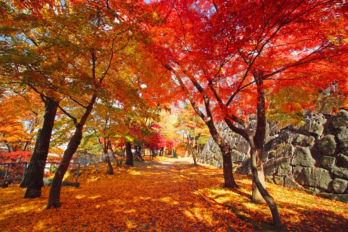
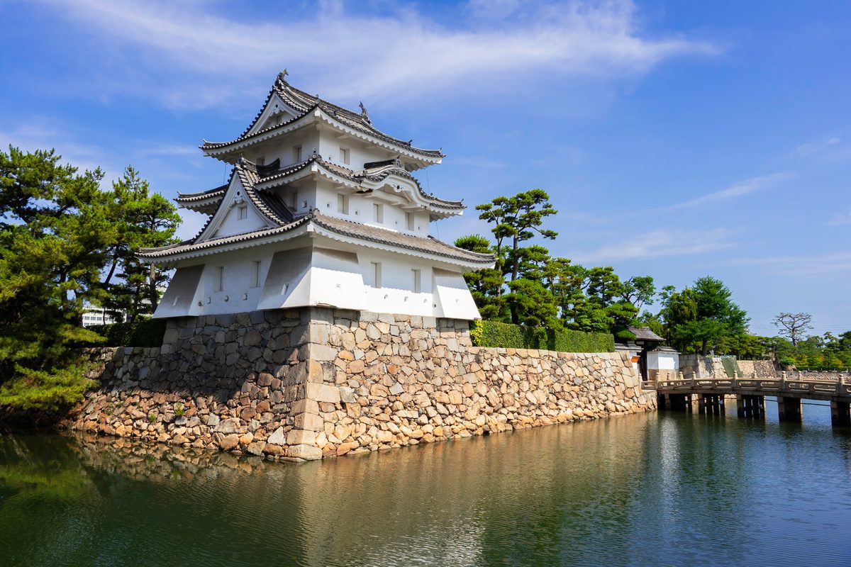
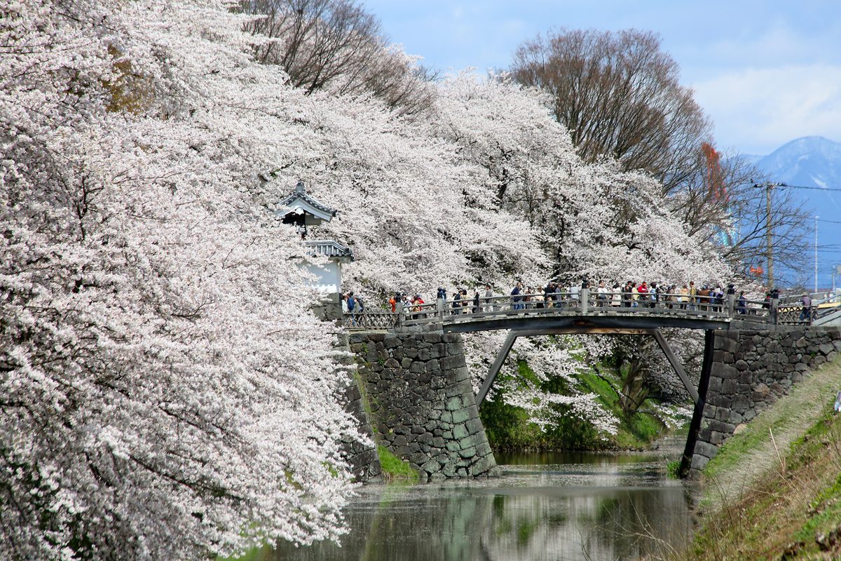
The castle site is largely open parkland — the keep burned in the 19th century — but the stone walls and moats remain, and the cherry trees planted across the grounds are among the better urban blossom displays in Tohoku. On clear days, Iwate-san is visible to the west, a reminder of how close the highlands begin.
Koiwai Farm, in the hills outside Morioka, is a working dairy operation on a scale that feels closer to Hokkaido than to most Honshu farmland. The pastures are open to visitors; the ice cream is made on site; the view back towards the city gives a sense of how thinly populated the prefecture's interior really is.
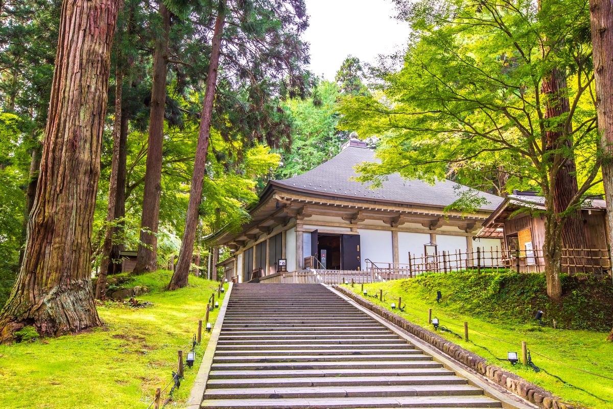
Morioka Castle Ruins
Iwate
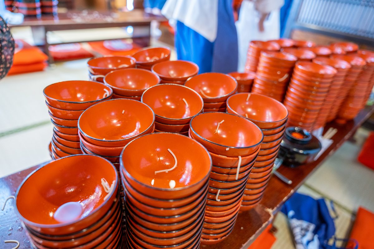
Morioka Wanko Soba Experience
Iwate
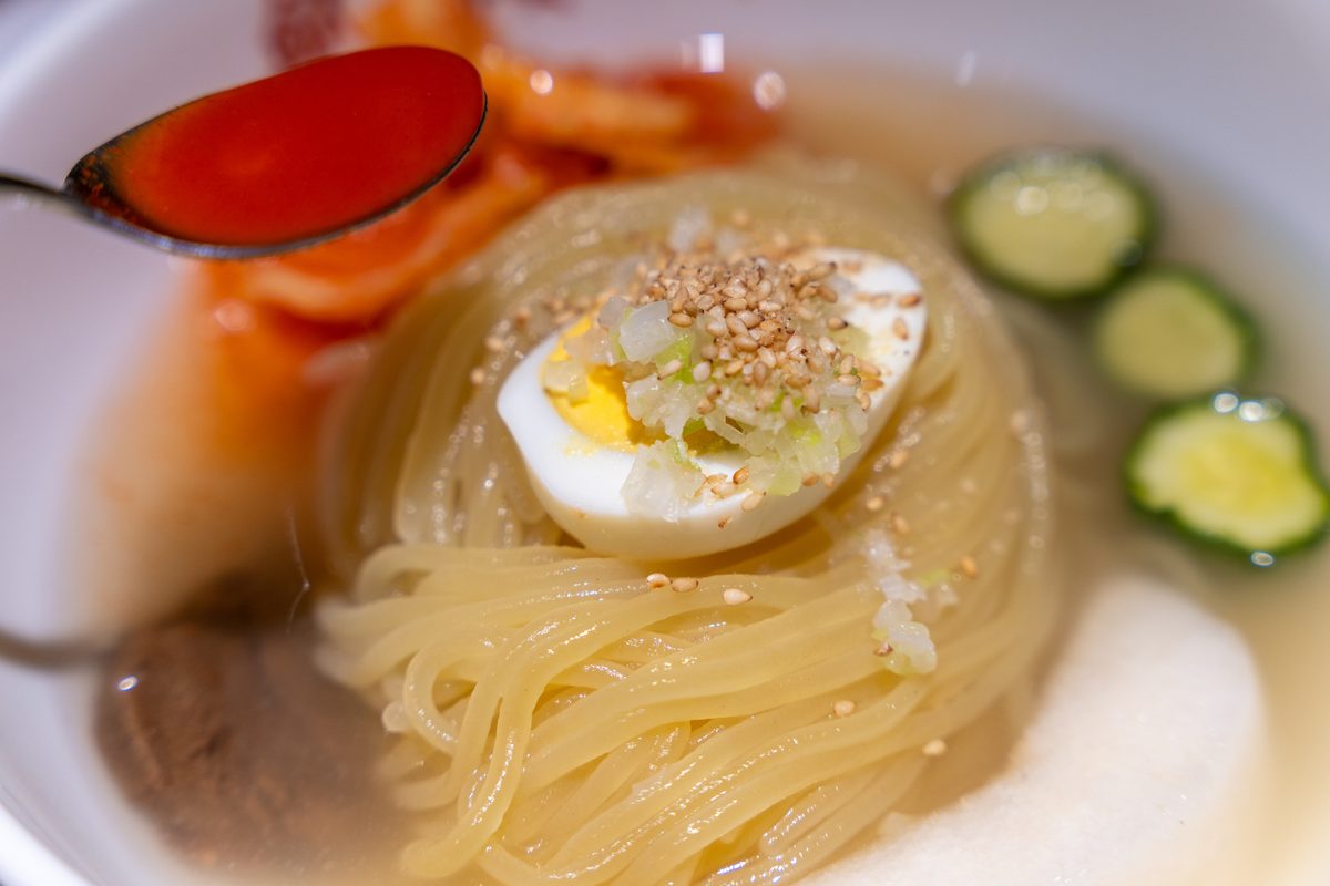
Morioka Cold Noodles (Reimen)
Iwate
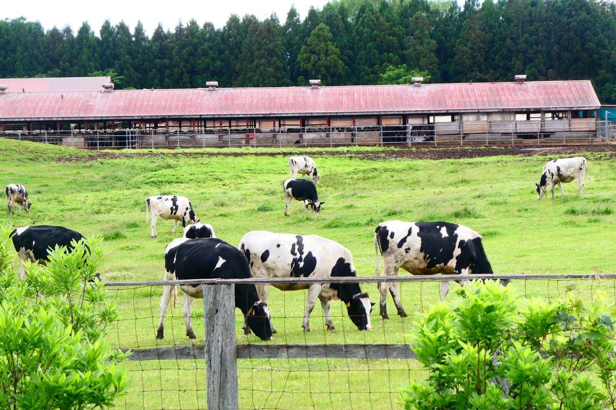
Koiwai Farm
Iwate
Hiraizumi — The Capital That Almost Was
Hiraizumi was the seat of the Northern Fujiwara clan in the 12th century, a court that imported culture from Kyoto and China on a scale ambitious enough that contemporary chronicles compared the town to the capital itself. The ambition ended in war; what remains are temple complexes scattered along the Kitakami valley.
Chusonji's Konjikido — the Golden Hall — is a small building entirely covered in gold leaf, housed inside a protective shell since the 17th century. It is among the most visually concentrated expressions of Heian-period Buddhism still standing in Japan. The approach through ancient cedar forest sets a tone that the museum-style presentation of the hall itself cannot quite match.
Motsuji preserves a Pure Land garden pond in a state close to its original 12th-century design — rare enough that UNESCO cited both sites when registering Hiraizumi as World Heritage in 2011. The pond reflects the surrounding hills with a stillness that feels deliberate; the temple buildings around it are largely reconstructions, but the garden is the reason most people stay longer than an hour.
Explore Hiraizumi spots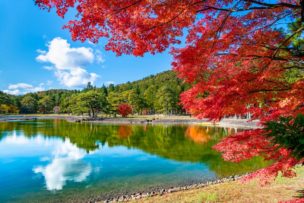
The Sanriku Coast — Cliffs, Bays, and the Shape of the Shore After 2011
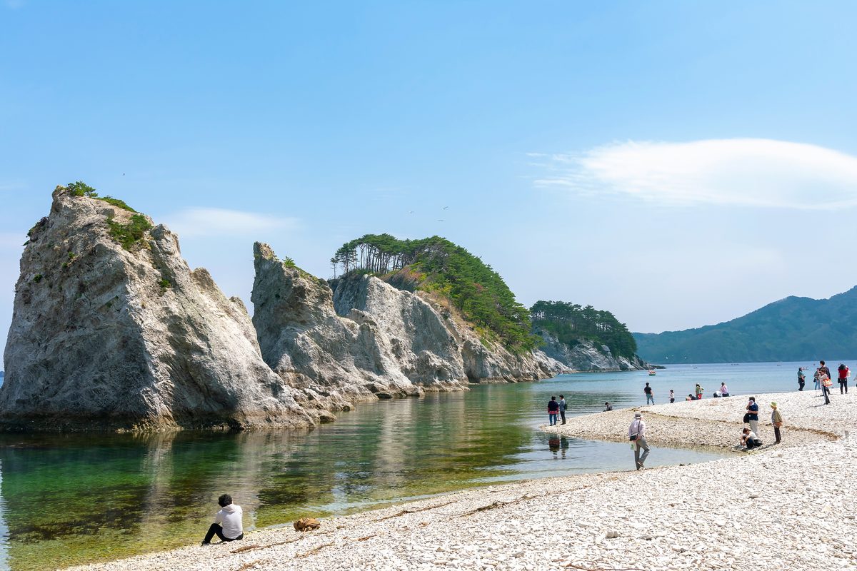
The Rikuchu coast along Iwate's eastern edge is rias coastline — deep inlets, exposed headlands, and fishing villages wedged into narrow valleys. Jodogahama, near Miyako, is the most visited single site: white rhyolite cliffs, turquoise water, and a short walking loop that stays busy on summer weekends.
Kitayamazaki, further north near Tanohata, is a different proposition — 200-metre cliffs dropping straight into the Pacific, viewed from a walking trail and observation decks that emphasise vertical scale over beach access. The two sites are several hours apart by car along a coast road that was heavily damaged in the 2011 tsunami and rebuilt with raised sea walls and relocated communities visible from the highway.
Visiting both in one day without a car is impractical; choosing one or the other based on whether you prefer sheltered coves or exposed cliffs is more honest than trying to tick both boxes.
Explore Sanriku spots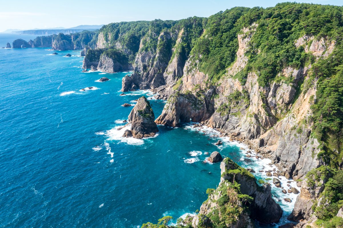
Geibikei — Two Kilometres of Gorge by Rowboat
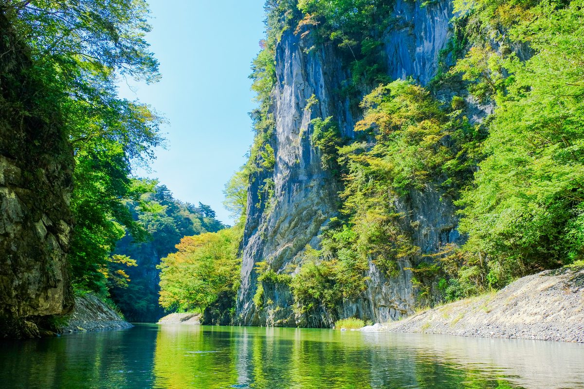
Geibikei is a two-kilometre limestone gorge on the Satetsu River, navigated by flat-bottomed boats poled upstream by boatmen in traditional dress. The trip takes around 90 minutes round trip; the return is faster with the current. The cliffs are densely forested; the water is clear enough to see the riverbed in places; the experience is quieter than the visitor numbers might suggest, because motor traffic is absent.
The gorge is at its best in late spring, when the maples on the cliffs are still opening, or in October, when the colour turns the canyon walls into a vertical gradient of red and yellow. Mid-summer is humid and crowded; mid-winter runs only on calm days when ice does not block the channel.
Geibikei sits on the same train line as Hiraizumi — the two pair naturally as a long day from Morioka or an overnight in Ichinoseki.
Explore Geibikei spotsHanamaki — Onsen Town and Kenji Miyazawa's Landscape
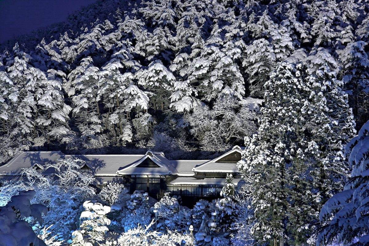
Hanamaki is an onsen town spread along a river valley at the edge of the Ou range, known nationally as the birthplace of author Kenji Miyazawa — whose fantastical children's stories drew heavily on the surrounding countryside. Museums dedicated to his life dot the area; the hot springs are the more durable draw.
The baths range from large resort hotels to small public sento; the water is alkaline and relatively soft, suitable for long soaks. The town itself is low-rise and unhurried, with enough independent restaurants to make an overnight stay more appealing than a rushed afternoon visit.
Hanamaki works as a stopping point between Morioka and the coast, or as a quieter alternative base for exploring the prefecture's interior without staying in the capital every night.
Explore Hanamaki spotsTono — The Town That Collected Japan's Folk Tales
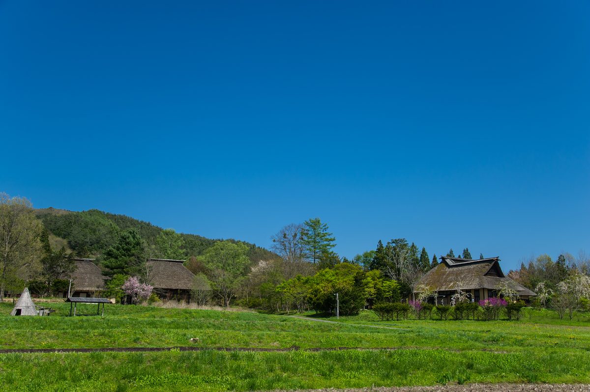
Tono is a small inland town in the central Iwate highlands, famous primarily for the collection of folk tales published under its name in the early 20th century — stories of zashiki-warashi household spirits, mountain kami, and farmers who crossed paths with beings that were not quite human.
The Furusato Village on the town's edge reconstructs traditional farmhouses and watermills in an open-air setting that borders on theme-park territory but preserves enough architectural detail to be instructive. The surrounding hills are working farmland; the pace is slow enough that walking between sites feels natural rather than staged.
Tono sees fewer foreign visitors than Hiraizumi or Morioka; the appeal is specific — if Japanese folk narrative and highland agriculture interest you, it rewards a half-day. If not, the train ride through the valleys is still among the prettier local lines in Tohoku.
Explore Tono spotsHachimantai & Iwate-san — Plateau Walking and Honshu's Second-Highest Peak
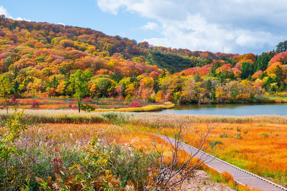
The Hachimantai plateau straddles the border with Akita — a high volcanic plain of marshes, small lakes, and walking trails that stay cool even when Morioka is humid below. In winter, the area receives enough snow to support cross-country skiing and snowshoeing without the crowds of Hokkaido's major resorts.
Iwate-san, at 2,038 metres, is the highest peak entirely within Iwate Prefecture and among the more serious day hikes in northern Honshu. The trail from the Hachimantai side climbs through forest before emerging onto volcanic scree near the summit; weather changes quickly, and the crater rim walk is not recommended in high wind.
Both destinations assume a car or a tolerance for infrequent buses. Combined, they justify a full day from Morioka with an early start; attempting both in one day is possible only in summer with a private vehicle.
Explore Hachimantai spots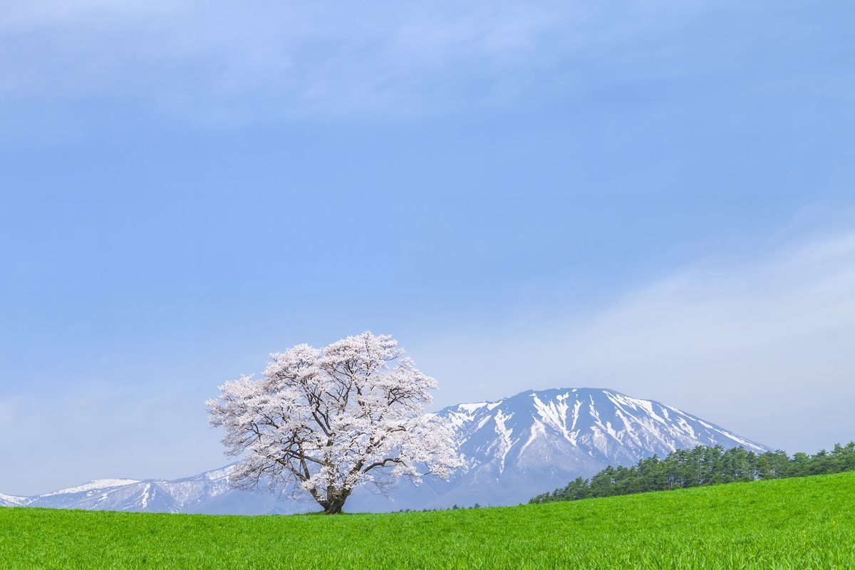
Ryusendo — One of Japan's Deepest Limestone Caves
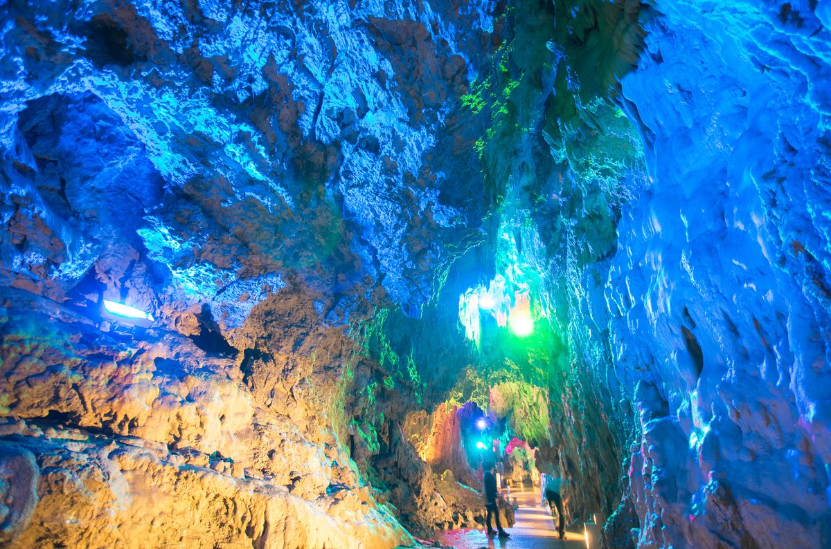
Ryusendo, near Iwaizumi on the northern Sanriku coast, is a limestone cave system explored through walkways and staircases that descend towards underground lakes of an almost unreal blue-green colour. The recorded depth exceeds 120 metres in places; only a fraction is open to visitors, but the vertical scale is obvious from the walkways.
The cave stays around 12°C year-round — bring a layer even in summer. The surrounding town of Iwaizumi has shrunk substantially with population decline; the cave is the primary reason most people visit, and the infrastructure reflects that honest dependence.
Reaching Ryusendo without a car requires a train to Miyako or Kuji and onward bus connections that run infrequently enough that checking timetables in advance is essential. A car from Morioka takes around three hours through mountain roads that reward the effort with coastal views on the final approach.
Explore Ryusendo spotsHow to Plan Your Iwate Trip
Morioka makes the most practical base — Shinkansen access, hotels at several price points, and restaurants dense enough to eat well for several nights without repeating choices. Hiraizumi and Geibikei pair naturally as a day trip south; the Sanriku coast requires either a car or patience with coastal trains that run infrequently north of Miyako.
A week allows Morioka, Hiraizumi, one Sanriku destination, Hanamaki, and either Tono or Hachimantai without rushing. Ryusendo realistically needs its own day if relying on public transport. Winter adds snow to the interior roads; summer brings humidity to the valleys and crowds to Jodogahama.
Iwate rewards travellers who accept distance as part of the experience — the prefecture is large enough that trying to cover everything in a few days produces frustration. Choosing a coast-and-inland split, or a northern-and-southern loop, works better than attempting a continuous circle.
Where are these spots?
How to Get There
Morioka Station is on the Tohoku Shinkansen line; Hayabusa services from Tokyo take around 2 hours 15 minutes. The JR Tohoku Main Line and Ofunato Line connect Morioka to Ichinoseki, Hanamaki, and the coast. Local buses serve Hiraizumi, Geibikei, and Tono; Sanriku coastal towns are linked by the Sanriku Railway and JR lines with limited frequency. Hachimantai and Ryusendo are significantly easier with a car. Rental cars are available at Morioka Station.
Find your Japan
Find Your Iwate
Browse curated spots across Iwate Prefecture — from World Heritage temples to the Sanriku coast — on Tobira.
Find match spotsMore Prefecture Guides
Kagawa: Udon, Art Islands, and the Most Climbed Stairs in Shikoku
11 min read
Tokushima: Whirlpools, the Valley That Time Missed, and Japan's Loudest Dance
11 min read
Kochi: The Wild Coast That Japan Forgot to Tame
12 min read
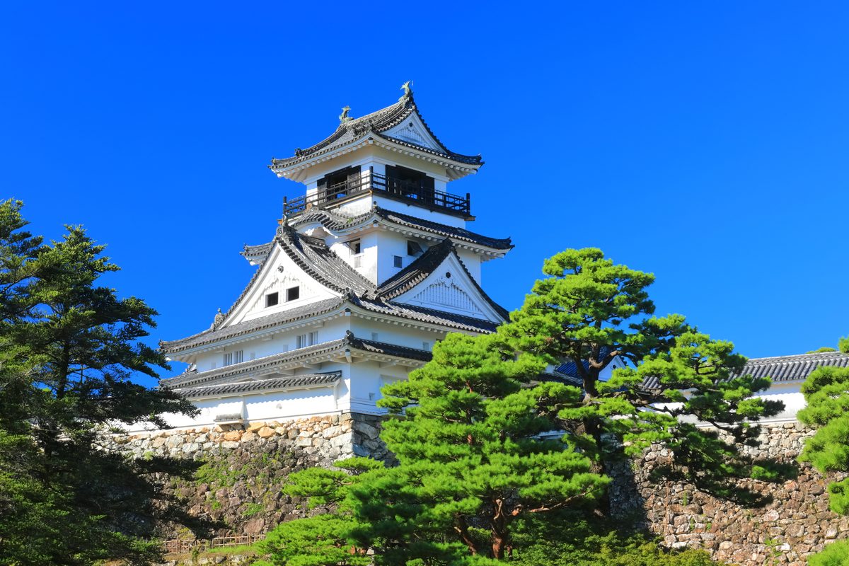
Ehime: Islands, Castles, and the Road That Goes Between
13 min read
Fukushima: Three Regions, One Prefecture, No Simple Story
12 min read
Akita: Snow Country, Rice Country, and Monsters on New Year's Eve
12 min read
Yamagata: Cherries, Sacred Mountains, and Snow That Eats the Trees
12 min read
Miyagi: The Coast, the Castle, and Sendai Between Them
11 min read
Aomori: Where Winter Invented Its Own Festival
12 min read
Kagoshima: Where the Mainland Finally Runs Out of Land
12 min read
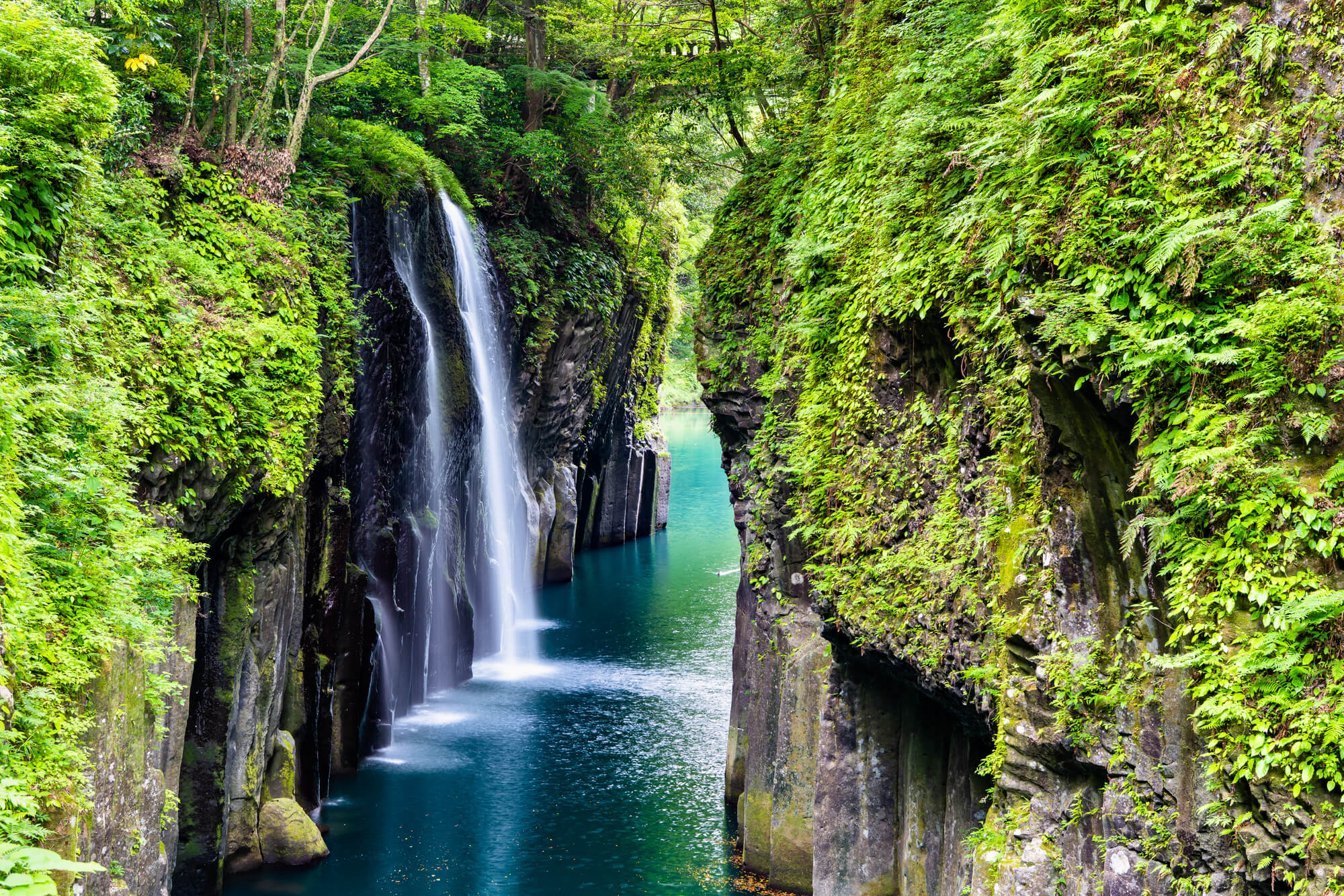
Miyazaki: Where the Sun God Hid and the Horses Run Wild
11 min read
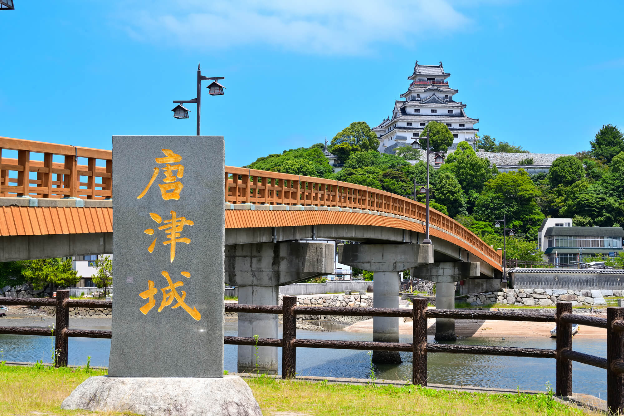
Saga: Older Than You Think, Quieter Than Most
11 min read
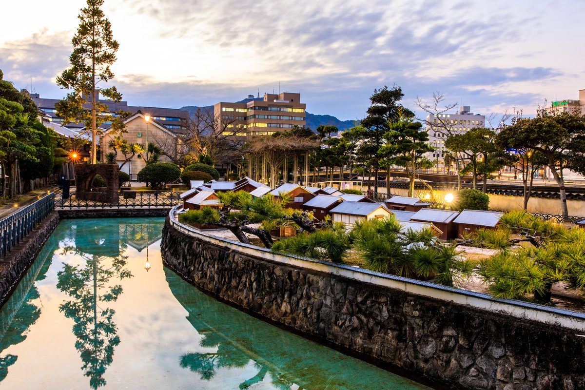
Nagasaki: Where Every Century Left Something Behind
13 min read
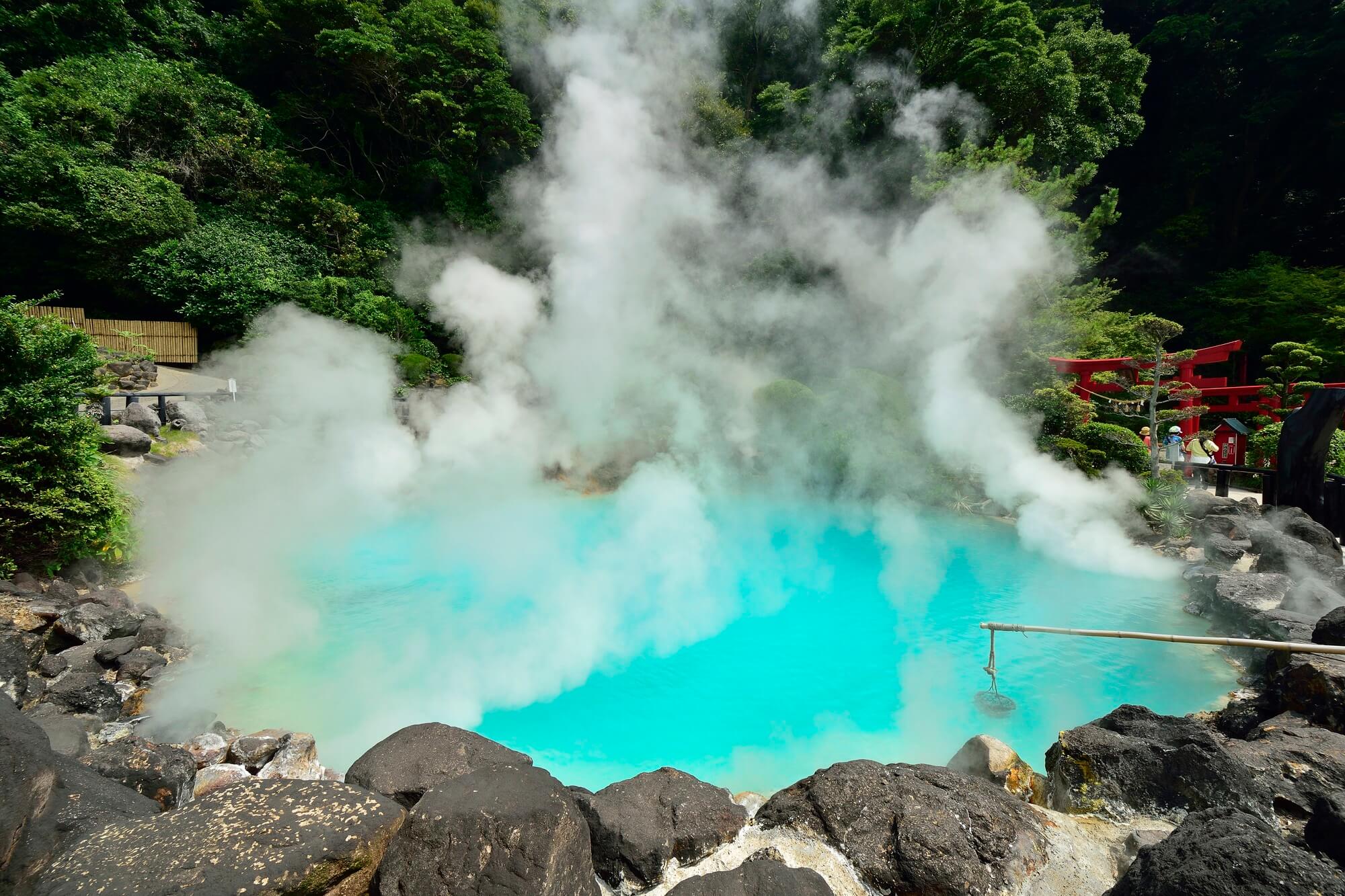
Oita: Where the Earth Still Boils
12 min read
Fukuoka: Where Japan Eats, Breathes, and Gets On With It
14 min read
Hokkaido Travel Guide: Ten Places Beyond Sapporo
16 min read